15 - 16 MARCH 1998 - 15/21.00 - 16/00.00 UTC - KEY PARAMETERS ON ISOBARIC SURFACES

by ZAMG


16 March 1998/00.00 UTC - Meteosat IR image; red: height contours 1000 hPa, green: height contours 500 hPa
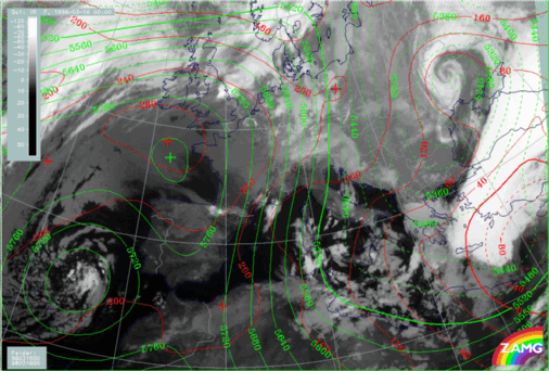
The height fields show that the Mediterranean surface low and the upper level trough have moved to the easternmost parts of the Mediterranean and to Turkey. The two upper level trough systems are now uncoupled again (as was the case at the start of this case study (compare 06.00 UTC - Key parameters on isobaric surfaces). The reason for this is that the southern trough has moved more quickly than the northern one, which is still located over Greece exactly in the area of the low level cloud system. In the same area a secondary small-scale trough has developed close to the surface (extending from Crete across the west Peloponnesus to south Italy). Such a distribution is a typical feature for cold air cloudiness and therefore has to be kept in mind and observed further.
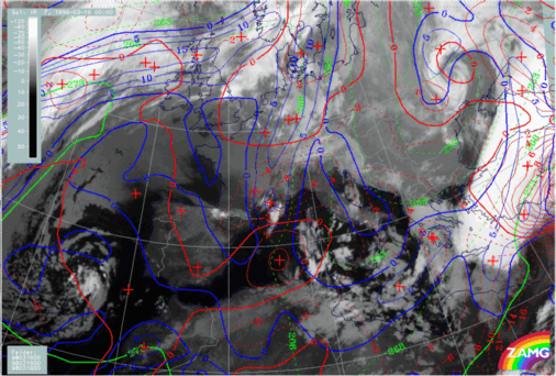
16 March 1998/00.00 UTC - Meteosat IR image; blue: thermal front parameter (TFP) 500/850 hPa, green: equivalent thickness 500/850 hPa, red: temperature advection 1000 hPa
In the frontal parameters a rather complicated TFP structure can be noticed. From the west coast of Turkey in north-eastward directions there is only one TFP zone (which is also in front of a distinct thickness gradient), but two TFP zones have developed over and south-east of Greece respectively. The thickness fields with a lack of any distinct gradient indicate that these TFP branches do not represent classical frontal zones; the one over Greece is connected with the low cloud area in the surface and upper level trough, the south-eastern one forms the north-eastern boundary of the distinct surface low. The complete area from the Balkan Peninsula across Greece to the coast of Turkey is under the influence of CA, while over Turkey strong WA prevails.
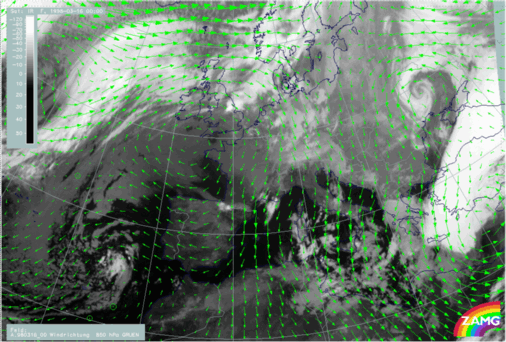
15 March 1998/18.00 UTC - Meteosat IR image; green: wind vectors 850 hPa
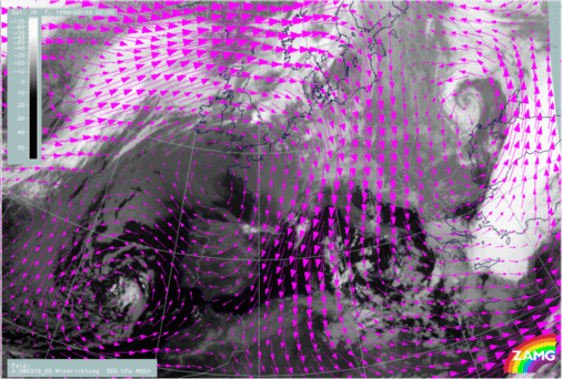
15 March 1998/18.00 UTC - Meteosat IR image; magenta: wind vectors 500 hPa
The wind vector fields for 850 hPa (left image) and for 500 hPa (right image) do not show any overall changes apart from of course advection. At 850 hPa there is a strong and broad north to north-east flow from Russia to Greece and Turkey (except the south and south-east parts of Turkey) and at 500 hPa western directions dominate with north-west and south-west components, depending on the location at the leading respectively or side of the trough.

SUB-MENU OF 15 - 16 MARCH 1998
15/21.00 - 16/00.00 UTC - OVERVIEW OF SATELLITE IMAGERY
15/21.00 - 16/00.00 UTC - FRONTAL DIAGNOSIS - USE OF VERTICAL CROSS SECTIONS