Warm Front Band - Special Investigation: Different Kinds of Warm Front Development
by ZAMG
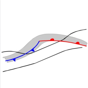
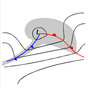
The most common development of a Warm Front Band is connected to classical Norwegian Model of the polar front theory; that means that Cold Fronts and Warm Fronts develop if a disturbance is superimposed on the (in the beginning stationary) polar front (see also Occlusion: Warm Conveyor Belt Type).
|
|
|
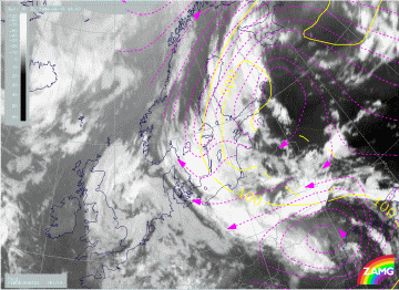
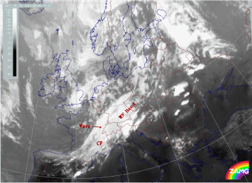
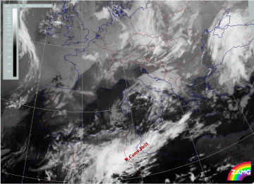
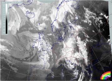
09 August 2001/15.00 UTC - Meteosat IR image
|
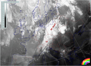
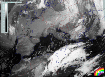
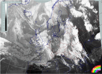
09 August 2001/18.00 UTC - Meteosat IR image
|
|
|
|
|
|
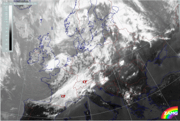
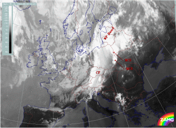
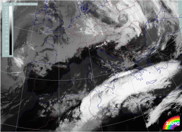
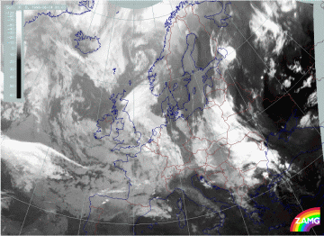
10 August 2001/06.00 UTC - Meteosat IR image
|
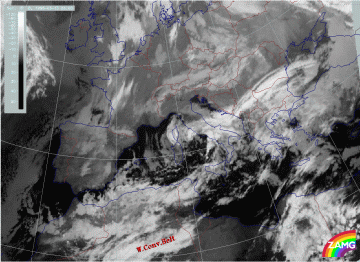
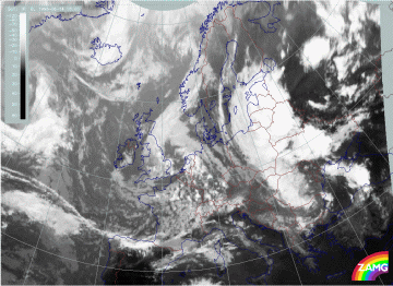
10 August 2001/12.00 UTC - Meteosat IR image
|
There are two examples in the "Case Study" part of this manual:
- The case from 13 - 15 March 1998 which shows the development of a very pronounced Warm Front cloud band over the Eastern Mediterranean/Turkey. Its initial stages can be followed backwards to the Sahara where cloudiness in the typical form of a Warm Conveyor Belt can be observed.
13 March 2001/06.00 UTC - Meteosat IR image13 March 2001/18.00 UTC - Meteosat IR image
 14 March 2001/06.00 UTC - Meteosat IR image14 March 2001/12.00 UTC - Meteosat IR image15 March 1998/06 UTC - IR image; SatRep overlay: names of conceptual models; symbols: weather events (green: rain and showers, blue: drizzle, cyan: snow, purple: freezing rain, red: thunderstorm with precipitation, orange: hail, yellow: fog, black: no actual precipitation or thunderstorm with precipitation); lines: magenta: relative streams on 308 K, yellow: isobars, system velocity 273° 7 m/s
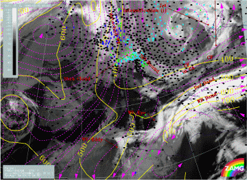
- The case from 14 - 15 June 1998
(see
Case Study 14 - 15 June 1998
)
which shows a Warm Front cloud band moving from SE Europe across Finland and the Scandinavian countries westward. The initial stages of cloudiness can be found over the Balkan Peninsula within a warm air mass.
13 June 1998/06.00 UTC - Meteosat IR image13 June 1998/18.00 UTC - Meteosat IR image
 14 June 1998/06.00 UTC - Meteosat IR image14 June 1998/12.00 UTC - Meteosat IR image15 June 1998/06 UTC - IR image; isobars (yellow) and relative streams (magenta) on 324K