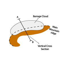
Barrage Cloud - Typical Appearance In Vertical Cross Sections
by ZAMG
- Isentropes:
- Flat minimum of equivalent potential temperature on the windward side of the mountain ridge
- Relative humidity:
- A maximum of relative humidity on the windward side indicates the position of the Barrage cloud and the area of confluence
- A maximum towards higher levels indicates the ascent of humid air during the flow over the barrier
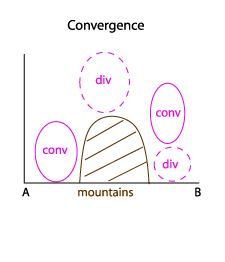
- Divergence:
- A distinct maximum of convergence at low levels confirms confluence in the windward Barrage area
- At higher levels on the windward side a minimum can be seen which is in accordance with the concept of compensation of convergence at upper levels.
- The opposite process takes place on the lee side with a maximum of convergence at upper levels and a minimum below.
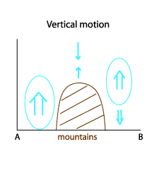
- Vertical motion:
- A maximum of upward motion can be seen directly over the wind ward mountain slopes
- On the lee side the maximum of upward vertical motion is positioned at higher levels with sinking air below.
|
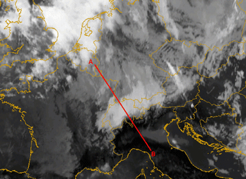
12 January 2007/12.00 UTC - Meteosat 8 IR10.8 image; position of vertical cross section indicated
|
|
|
|
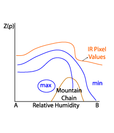
Relative humidity
|
12 January 2007/12.00 UTC - Vertical cross section; black: isentropes (ThetaE); blue: relative humidity; orange thin: IR pixel values; orange
thick: WV pixel values
|
|
|
|
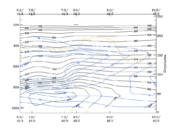
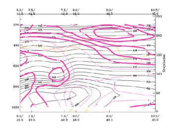
Divergence
|
12 January 2007/12.00 UTC - Vertical cross section; black: isentropes (ThetaE); magenta: divergence, thick: convergence; orange thin: IR pixel
values; orange thick: WV pixel values
|
|
|
|
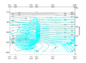
Vertical motion
|
12 January 2007/12.00 UTC - Vertical cross section; black: isentropes (ThetaE); cyan thick: vertical motion (omega) - upward motion, cyan thin: vertical motion (omega) - downward motion; orange thin: IR pixel values; orange thick: WV pixel values
|
|
|
|


