POLAR LOW - CLOUD STRUCTURE IN SATELLITE IMAGES
by KNMI
This Conceptual Model is based on existing literature and the investigations of 25 cases, most of them in the winter seasons of 1999-2000 and 2000-2001.
Three different phases in the life cycle of a Polar Low can be distinguished: the initial/development phase, the mature phase and the decaying phase.
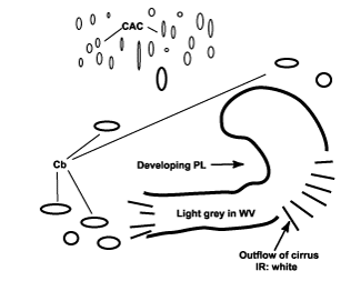
- A developing Polar Low has the strucutre of a cyclonic curl in a polar or arctic airmass far away from the main polar frontal zone. Upstream of the cloud band, Cold Air Cloudiness (CAC) with relatively low tops (dark in IR) is present. The inner part of the curl shows sharp cloud edges while the outer part is often capped by cirrus cloud.
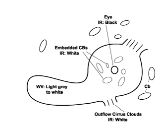
- The cloud structure of a mature Polar Low is often a pronounced vortex with a (partly) cloud free eye. This
vortex consists of Cbs. The deepest Cbs with the brightest cloud tops in the IR images are located around the eye.
A cirrus shield often partly covers small-scale Polar Lows.
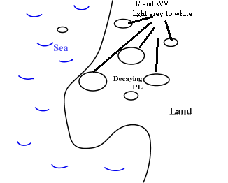
Clouds further away from the centre tend to be less bright which means lower cloud tops, caused by descending air motion. - A decaying Polar Low is indicated by the disappearance of the cirrus cloud and the eye feature, lower cloud tops (less bright in IR images) and the disruption of the vortex. Most Polar Lows will decay as a result of landfall.
|
Developing Phase
|
Mature Phase
|
|
|
|
|
|
Decaying Phase
|
|
22 February 2001/21.00 UTC - Meteosat IR image; Developing Polar Low near the Faroe Islands
|
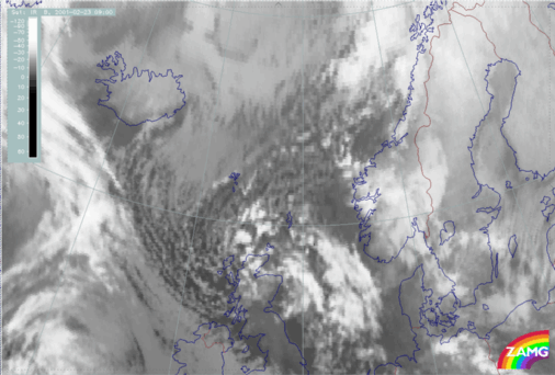
23 February 2001/09.00 UTC - Meteosat IR image; Mature Polar Low south east of Scotland
|
|
|
|
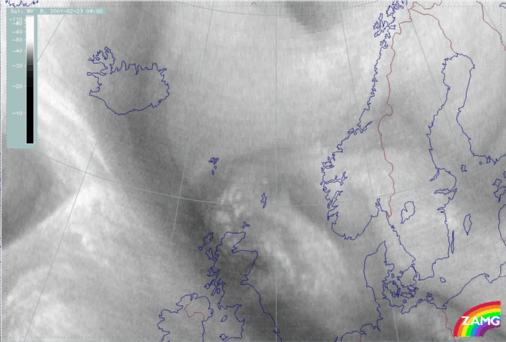
22 February 2001/21.00 UTC - Meteosat WV image; Developing Polar Low near the Faroe Islands
|
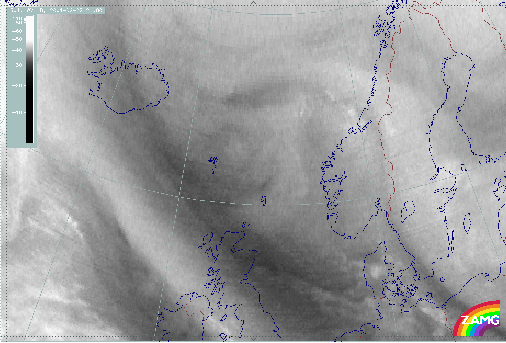
23 February 2001/09.00 UTC - Meteosat WV image; Mature Polar Low south east of Scotland
|
|
|
Appearance in AVHRR imagery
As Polar Lows are phenomena which frequently occur in the dark winter season, the use of combined VIS-IR images is normally not possible, however, single channel NOAA IR images (e.g. Ch 4) are most appropriate for the detection of Polar Lows.|
26 February 1987/04.28 UTC - NOAA CH4 image; Developing polar low north of Norway
|
27 February 1987/04.18 UTC - NOAA CH4 image; Mature polar low north of Norway
|
|
|
|
|
|
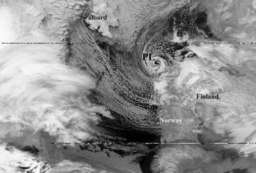
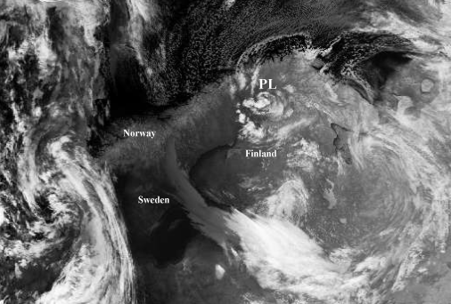
27 February 1987/12.32 UTC - NOAA CH4 image; Decaying polar low over Norway
|
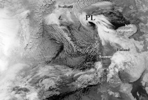
A few hours later a mature Polar Low is positioned just north of Norway with a clear eye and numerous Cbs encircling the center. An area of clouds with low tops, as a result of descending air, surrounds these Cbs.
Finally, having passed across the north coast of Norway, the Polar Low starts to lose its well-organized structure.In the last satellite image,only some unstructured Enhanced Cumuli are left over north Norway and Sweden.

