Lee Cloudiness - Cloud Structure In Satellite Images
by ZAMG
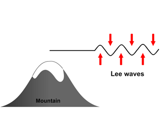
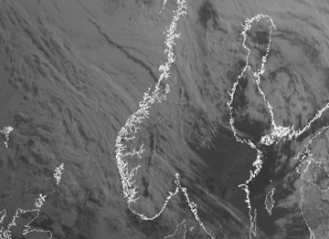
- Lee Wave Clouds, which are characterised by narrow middle level cloud bands perpendicular to the wind direction and parallel to the mountain chain. The length of the wave varies in range from about 3 - 40 km. They can easily be observed with high resolution images (e.g. Meteosat Second Generation and METOP polar orbiting satellite). Their crests are always white in the visible image but in the IR image they can vary from white to dark grey depending on their temperature (cloud top height).
|

|
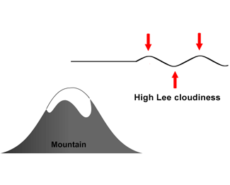
- High Lee Cloudiness consisting of cirrus clouds that extend from the mountain chain over the leeward side, and continue for up to 1000 km. They are also formed by Lee Waves but have a much larger wave length. They are very bright in the IR image with cloud top temperatures ranging from -35 to -55°C but rather grey or translucent in the VIS image. Sometimes in strong winds they become detached from the mountain and then seem to start far away from the obstacle.
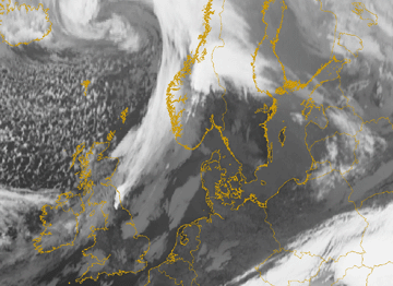
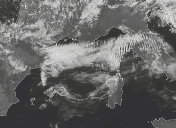
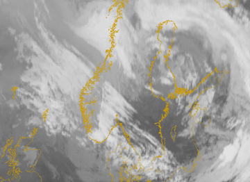
Sometimes Lee Wave Clouds and High Lee Cloudiness can be observed together. In this case the IR image is the best tool for the identification of High Lee Cloudiness, just south of the Austrian Alps; the HRVIS image for the lower Lee Wave Clouds over Slovakia and Hungary is also evident. The high resolution shows the existence of Lee waves very well
|
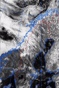
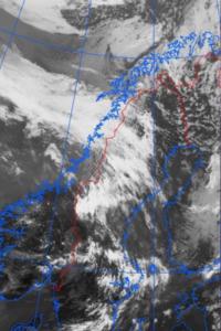
18 March 2005/07.45 UTC - Meteosat 8 HRVIS image
|
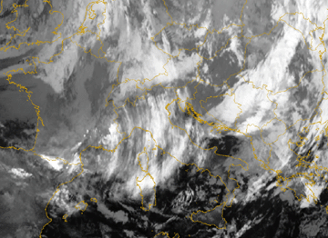
18 March 2005/06.00 UTC - Meteosat 8 IR10.8 image
|
|
|
|
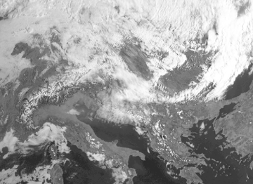
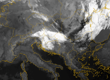
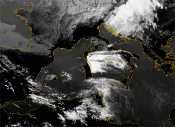
28 June 2005/04.45 UTC - Meteosat 8 HRVIS image
|
28 June 2005/04.45 UTC - Meteosat 8 IR10.8 image
|
|
|
Both types of Lee Cloudiness are frequently found over many mountain chains in Europe. In Europe they can be found at the Pyrenees, the Alps, the Carpathians Mountains, the Scandinavian Mountains, the Central Mountains in France, Iceland, the Apennines, the Cantabrian Mountains, the High Tatra, the mountains of Scotland, the mountains of England (Wales), Corsica and the East coast of Spain. Lee Cloudiness can also be found sometimes in Portugal, Greece, the Azores, the Baleares and the Faeroes Islands.
Lee Cloudiness normally has a duration of only several hours. Only in very few cases will it survive more than one day. The spatial scale ranges from small cloud patches (limitation is the resolution of the observation) up to several hundred kilometres.
Lee Wave Clouds are detected quite easily in VIS images. Identification of High Lee Cloudiness is more difficult; for instance High Lee Cloudiness and MCSs can have the same shape and brightness. Since Lee Cloud is associated with its mountain there is normally no propagation upwind. So discrimination between Lee Cloudiness and other possibly superimposed conceptual models such as moving systems is possible. Satellite loops can also be used to determine if Lee Cloudiness is detached from the mountain chain by strong winds.
|
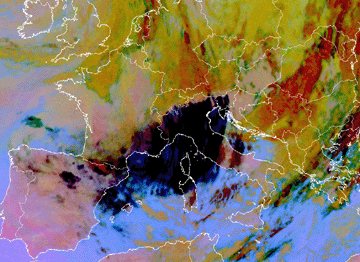
12 November 2006/23.00 UTC - Meteosat 8 Dust RGB image
|
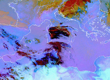
8 May 2005/09.00 UTC - Meteosat 8 Dust RGB image
|
|
|
Appearance in AVHRR imagery
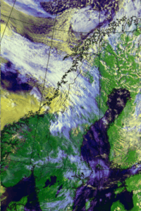
- Narrow cloud lines parallel to the mountain ridge line consist mostly of low or middle level clouds with a width of about 3 - 40 kilometres for both the cloud and the cloud-free lines. In NOAA 124 images they have white or yellow colour and in NOAA 345 images mostly cyan or light red colour.
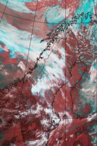
- The NOAA 345 image is the most suitable tool to study High Lee Cloudiness. In the 345 image Lee Clouds are seen as white and are well identifiable against the dark red colour of the surface.
- A stationary Ci plume of High Lee Cloudiness can extend hundreds of kilometres downwind from the mountain ridge and has a sharp edge over the mountain chain. In AVHRR images the plume may have either a uniform or striped appearance. Ci plumes develop at high levels, therefore they are seen as white or blue in NOAA 124 images and mainly white in NOAA 345 images.
- Lee Clouds are sometimes associated with strong down slope winds causing a narrow dry zone along the lee slope. This can result in a gap in the Lee Cloudiness just behind the mountain ridge, clearly identifiable in AVHRR images.
|
28 July 1999/15.34 UTC - NOAA RGB image (channel 1, 2 and 4)
|
28 July 1999/15.34 UTC - NOAA RGB image (channel 3, 4 and 5)
|
|
|
|
28 July 1999/15.34 UTC - NOAA Ch2 image
|
28 July 1999/15.34 UTC - NOAA Ch4 image
|
|
|

