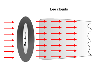
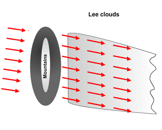
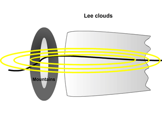
Lee Cloudiness - Key Parameters

by ZAMG


Wind direction with respect to the orientation of the mountain chain is the most important parameter when detecting Lee Cloudiness of either type. The wind direction need not necessarily be perpendicular to the mountain chain but there must be a normal component. In the Pyrenees region most wind directions can produce High Lee Cloudiness (only east winds were found not to do so, but this is more due to general climatology). The orientation of the developed High Lee Cloud is consistent with the direction of the wind flow causing it.
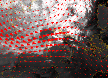
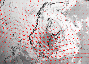
04 July 2007/06.00 UTC - Meteosat 8 IR10.8 image; red: wind vectors 500 hPa
In this case there are westerly winds. The Lee Cloudiness is formed over the mountains in Corsica which are oriented perpendicular to the wind direction. The Lee clouds can be found over the Mediterranean and extend even over Italy.
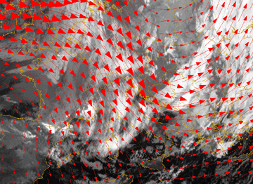
13 November 2006/00.00 UTC - Meteosat 8 IR10.8 image; red: wind vectors 500 hPa
The image shows Lee Cloud formation at the Austrian and Swiss Alps: Wind flow from the north results in High Lee Cloudiness south of the mountain ridges. The cloud features are parallel to wind direction.
28 June 2005/04.45 UTC - Meteosat 8 HRVIS image, red: wind vectors 500 hPa
Lee Waves formed over mountains in Norway are orientated perpendicular to the wind direction.

Jet axis and thickness

High Lee Cloudiness often occurs along the right (anticyclonic) side of a jet stream, and sometimes in the jet exit region. Often it can be observed in baroclinic zones on the leading side of the synoptic-scale thickness ridge.
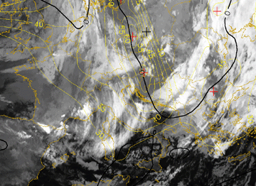
13 November 2006/00.00 UTC - Meteosat 8 IR10.8 image; yellow: isotachs 300 hPa, black: zero line of shear vorticity 300 hPa
In this image Lee Cloudiness at the Alps is situated along the anticyclonic side of the jet axis, indicated by the zero line (solid) of shear vorticity.

Stability (Showalter index)

The Showalter index ranges from 3 to 12 which indicate a stable atmosphere.

Looking more closely at stability (Showalter index is only the mean value of a layer) radio sondes mostly show a stable layer on top of a conditionally unstable layer. Above there is again a conditionally unstable layer. (see Meteorological physical background ).


Menu Of Lee Cloudiness
Meteorological Physical Background
Typical Appearance In Vertical Cross Sections