Orographical Effects on Frontal Cloud - Weather Events
by ZAMG and DHMZ
Front Delay
| Parameter | Description |
| Precipitation |
|
| Temperature |
|
| Wind (incl. gusts) |
|
| Other relevant information |
|
|
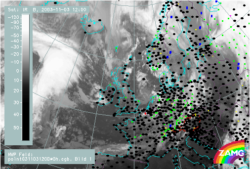
06 May 2003/06.00 UTC - Meteosat IR image; weather events (green: rain and showers, blue: drizzle, cyan: snow,
red: thunderstorm, black: no precipitation)
|
|
|
Decoupling of clouds at different heights
| Parameter | Description |
| Precipitation |
|
| Temperature |
|
| Wind (incl. gusts) |
|
| Other relevant information |
|
|
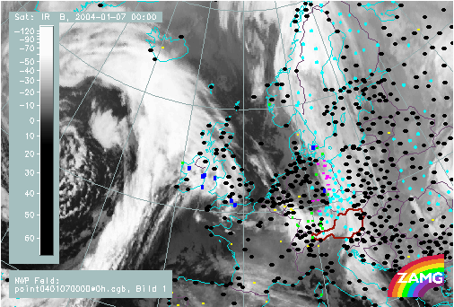
07 January 2004/00.00 UTC - Meteosat IR image; weather events (green: rain and showers, blue: drizzle, cyan: snow,
red: thunderstorm, black: no precipitation)
|
|
|


