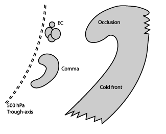
Comma - Cloud Structure In Satellite Images
by ZAMG and KNMI
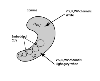
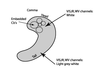
In order to distinguish the Comma from other features in cold air, the Comma cloudiness is defined as a small to meso-scale cloud spiral consisting of white (i.e. cold) cloud cells partly overlaid by cirrus shields. In most cases the strongest convection can be found in the Comma tail, but sometimes enhanced convection can also be found in the Comma head. In a few cases the Comma head and tail are separated by a narrow cloud-free area or only connected by low clouds (although this may not be apparent during the whole life time of the system). The scale of a Comma lies between 200 and 1000 km, i.e. much smaller than a fully developed depression or a cyclone.
|
|
|
|
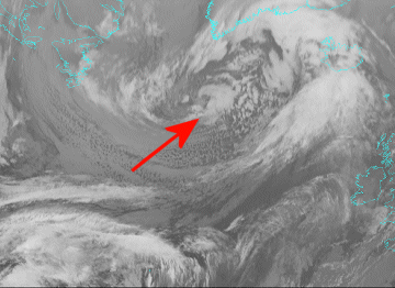
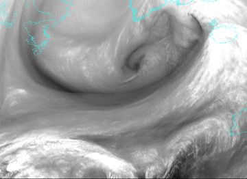
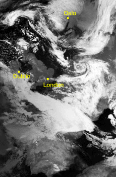
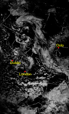
07 December 2004/15.00 UTC - Meteosat 8 IR 10.8 image
|
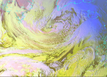
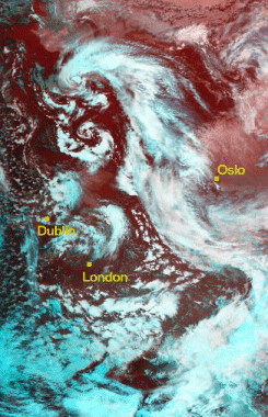
07 December 2004/15.00 UTC - Meteosat 8 WV 6.2 image
|
|
|
|
|
|
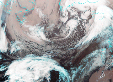
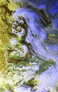
07 December 2004/15.00 UTC - Meteosat 8 RGB image (0.6, 1.6 and 10.8)
|
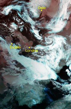
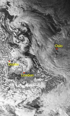
07 December 2004/18.00 UTC - Meteosat 8 RGB image (3.9, 10.8 and 12.0)
|
Appearance in AVHRR imagery
- Images from all channels (below) show more details of the cloud structure when compared to Meteosat 8 images.
- RGB-combinations of channels (below left, second row) provide a quick overview of thin and thick high level cloudiness.
- Channel manipulation (eg. subtraction with thresholding, third row, right) highlights the cloud pattern and physical features.
Concerning the Comma cloud pattern, high clouds are the only features to look at in AVHRR satellite images. The characteristics of such cloud are shown in the table below.
|
17 February 2000/04.35 UTC - NOAA RGB image (channel 3, 4 and 5)
|
17 February 2000/04.35 UTC - NOAA CH5 image
|
|
|
|
16 February 2000 /14.45 UTC - NOAA RGB image (channel 3, 4 and 5)
|
16 February 2000 /14.45 UTC - NOAA RGB image (channel 1, 2 and 4)
|
|
|
|
16 February 2000/14.45 UTC - NOAA CH2 image
|
16 February 2000/14.45 UTC - NOAA CH1 minus CH3B-
|
|
|

