Cold Front In Warm Advection - Cloud Structure In Satellite Images
by ZAMG and FMI
35 cases of CF in WA have been investigated here.
In satellite imagery the cloud bands of CF in WA look generally similar to Cold Fronts, but often they are weaker: Roughly one third of cloud bands consist only of low clouds, and almost half of them are more fibrous and broken than Cold Fronts.
As with Cold Front in Cold Advection, CF in WA can be a whole front, or a part of it (the rest of the front being either classical Cold Front or CF in CA).
CF in WA forms, when a Cold Front encounters warm air advection related to an another approaching system. Most often this happens, when a new wave forms within a Cold Front.
Appearance in METEOSAT imagery:
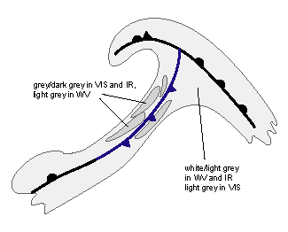
The appearance of CF in WA in different channels:
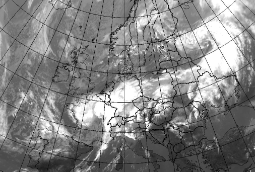
- In VIS images a light grey cloud band with some broken structure
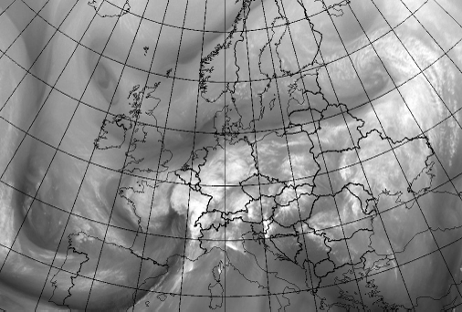
- In IR images grey, broken cloud band, which is clearly darker than other frontal parts of the system
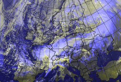
- In WV images a grey cloud band
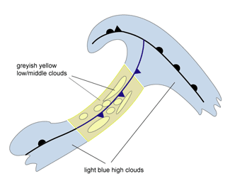
- In the combination (HRVis;HRVis;IR10.8i) greyish yellow cloud band with possibly some fractured fibres of light blue cirrus
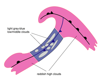
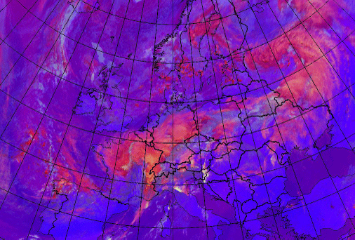
- In convection product (WV6.2-WV7.3; IR3.9-IR10.8; NIR1.6-VIS0.8) the front looks almost nonexistent in the area of warm advection, with only some grey-blue patchy cloudiness
|
|
|
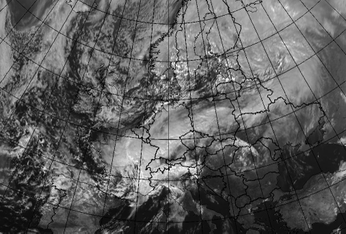
As a result, a Cold Front in Warm Advection is formed over Poland and Belarus.
|
03 October 2006/12.00 UTC - Meteosat 8 VIS 0.6 image
|
03 October 2006/12.00 UTC - Meteosat 8 IR 10.8 image
|
|
|
|
|
|
03 October 2006/12.00 UTC - Meteosat 8 WV 6.2 image
|
|
03 October 2006/12.00 UTC - Meteosat 8 RGB (HRVis;HRVis;IR10.8i) image
|
03 October 2006/12.00 UTC - Meteosat 8 RGB (WV6.2-WV7.3; NIR3.9-IR10.8; NIR1.6-VIS0.8) image
|
|
|

