Cold Front - Weather Events
by ZAMG and FMI
Ana Cold Front
| Parameter | Description |
| Precipitation (incl. thunder) |
|
| Temperature |
|
| Wind (incl. gusts) |
|
| Other relevant information |
|
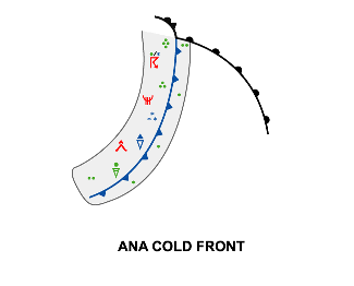
|
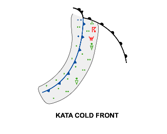
Kata Cold Front
| Parameter | Description |
| Precipitation (incl. thunder) |
|
| Temperature |
|
| Wind (incl. gusts) |
|
| Other relevant information |
|
|
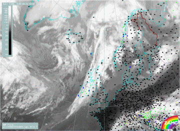
19 September 2005/12.00 UTC - Meteosat 8 IR 10.8 image; weather events (green: rain and showers, blue: drizzle,
cyan: snow, red: thunderstorm with precipitation, purple: freezing rain, orange: hail, black: no actual
precipitation or thunderstorm with precipitation); blue: thermal front parameter 500/850 hPa
|
|
|
|


