Convective Cloud Features In Typical Synoptic Environments: The Warm Sector - Meteorological Physical Background
by ZAMG
If such a situation occurs close to the Cold Front the effect is often increased by dry and cold air stream from behind the Cold Front overrunning the frontal zone at higher levels (see Thickness Ridge Cloudiness ).
The troposphere under such conditions is characterized by (see Key parameters ):
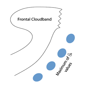
- a tongue of high values of equivalent potential temperature at a low level (usually at 850 hPa) representing moist, warm air
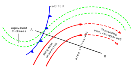
- warm advection in the lower and middle layers and cold advection above resulting in potentially unstable vertical stratification of the troposphere
- notable convergence in the lower layers (for instance from the surface up to 700 - 600 hPa), which is one process causing upward motion
- a rising warm conveyor belt throughout a thick layer of the troposphere
|
|
|
|
|
|
|
|
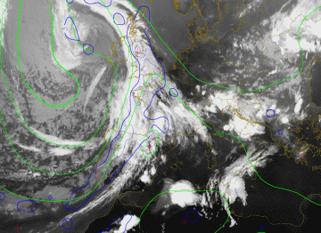
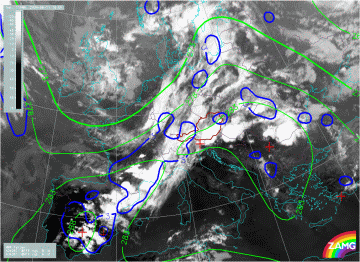
08 August 2004/18.00 UTC - Meteosat 8 IR 10.8 image; blue: thermal front parameter 500/850 hPa, green: equivalent thickness 500/850 hPa
|
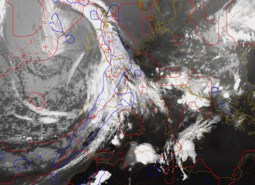
08 August 2004/18.00 UTC - Meteosat 8 IR 10.8 image; lines: thermal front parameter 500/850 hPa, red: temperature advection 700 hPa
|
|
|
|
|
|
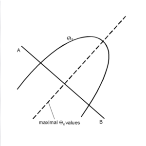
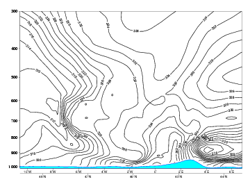
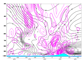
08 August 2004/18.00 UTC - Vertical cross section; black: isentropes (ThetaE)
|
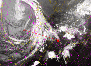
08 August 2004/18.00 UTC - Meteosat 8 IR10.8 image; magenta: relative streams 330K - system velocity: 260° 11 m/s, yellow: isobars 330K,
position of vertical cross section indicated
|
The above right image shows that the MCSs have developed within an area of WA within the lower and middle levels of the troposphere.
The relative streams are calculated on the isentropic surface of 330K.
The isentropic analysis shows that the MCSs have developed within the ascending relative stream (called upper relative stream). This relative stream rises from approximately 500 hPa to 400 hPa within the area of MCS development.
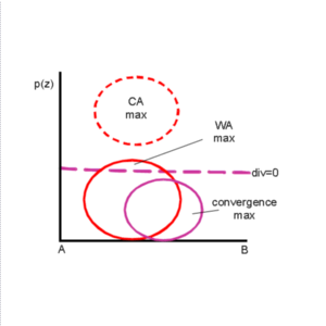
08 August 2004/18.00 UTC - Vertical cross section; black: isentropes (ThetaE), magenta thin: divergence, magenta thick: convergence
|
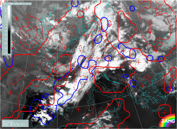
11 June 2004/18.00 UTC - Meteosat 8 IR 10.8 image; lines: blue: thermal front parameter 500/850 hPa, green: equivalent thickness 500/850 hPa
|
11 June 2004/18.00 UTC - Meteosat 8 IR 10.8 image; lines: blue: thermal front parameter 500/850 hPa, red: temperature advection 700 hPa
|
|
|
|
|
|
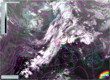
11 June 2004/18.00 UTC - Meteosat 8 IR 10.8 image; magenta: equivalent potential temperature 850 hPa
|
In the above left image, the Cold Front is characterized by a pronounced TFP close to the leading edge of the front and a high gradient of equivalent thickness within the cloud band (compare Cold Front). The MCSs have developed in the tongue of warm air ahead of the surface front (maximum values of TFP) which is also indicated by the model by high values of equivalent thickness.
In the above right image, the temperature advection field mostly shows weak WA where the MCSs have developed. The equivalent potential temperature at 850 hPa has a pronounced gradient within the Cold Front zone (lower left image). The MCSs can be found along the warmer side of this high gradient where the equivalent potential temperature has a maximum.
|
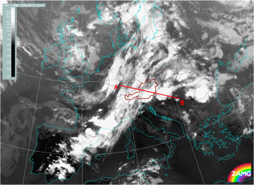
11 June 2004/18.00 UTC - Meteosat 8 IR 10.8 image; position of vertical cross section indicated
|
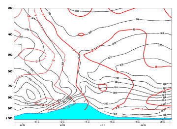
11 June 2004/18.00 UTC - Vertical cross section; black: isentropes (ThetaE), red temperature advection
|
|
|
|
|
|
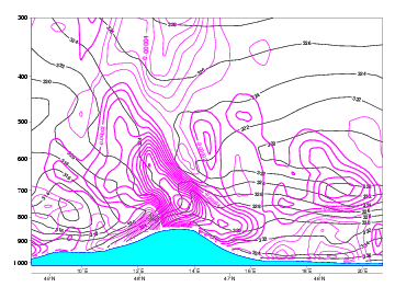
11 June 2004/18.00 UTC - Vertical cross section; black: isentropes (ThetaE), magenta: divergence
|
|
The isentropes area show an unstable stratified troposphere (decreasing values of equivalent potential temperature with height) within the the lower layers of the troposphere up to approximately 700 hPa. WA can be found in the lower levels and CA in the upper levels of the troposphere (above right image). The field of divergence (lower left image) does correspond to the ideal vertical distribution of divergence/convergence. The area of the MCS is indicated by very strong converging motion at lower levels and weak divergence at middle levels of the troposphere.


