Convective Cloud Features In Typical Synoptic Environments: Enhancement Of Convection By PV - Typical Appearance In Vertical Cross Sections
by KNMI and DHMZ
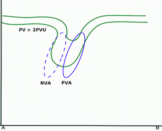
If this anomaly propagates over time, then ahead of the anomaly, positive vorticity advection occurs and to the rear, there is negative vorticity advection.
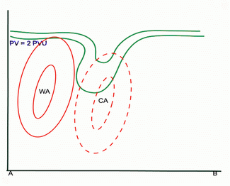
A large area of cold advection can very often be found near the PV anomaly. There is a forward tilt of the advection pattern, resulting in increasing cold advection with height (and therefore destabilisation). To the rear of the PV anomaly, an area of warm advection can often be found which may indicate an approaching new frontal system.
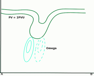
Just below the PV anomaly, at mid-tropospheric levels, the strongest upward and downward motion can be found.
Although cold advection and the vorticity advection tend to counteract each other, a maximum of upward motion can be detected, indicating that the contribution of vorticity advection must be larger than that of temperature advection. (see also
Numerical Parameters Indicative Of The Production Of Cloudiness: Omega Equation
).
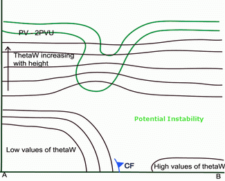
A sharp gradient of isentropes near the surface indicates the surface cold front (CF). To the rear of this CF, high values of ThetaW occur. The ThetaW inversion at levels between 700 and 800 hPa characterises an air mass which is potentially unstable. This causes, together with dynamical forcing, upward motion and subsequent convection.
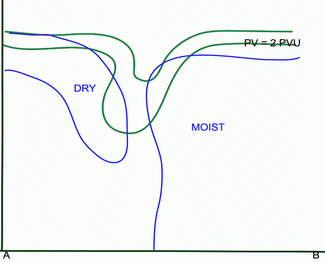
In the higher troposphere, behind the PV anomaly, there is a marked inflow of dry air with stratospheric origin, caused by strong downward motion. In WV imagery this can be seen as a narrow dark zone. To the rear of the CF, the relative humidity is high, especially at lower levels. This provides a supply of moisture for the development of convection.
PV and ThetaW
|
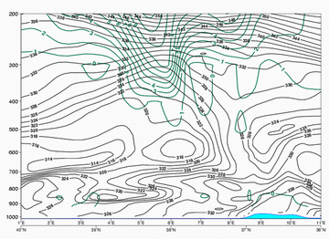
04 August 2006/12.00 UTC - Vertical cross section; dark green: potential vorticity, black solid: isentropes
|
|
|
|
PV and PVA
|
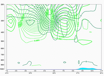
04 August 2006/12.00 UTC - Vertical cross section; dark green: potential vorticity, green thick: vorticity advection - PVA, green thin:
vorticity advection - NVA
|
|
|
|
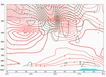
PV and TA
|
04 August 2006/12.00 UTC - Vertical cross section; dark green: potential vorticity, red thick: temperature advection - WA, red thin: temperature
advection - CA
|
|
|
|
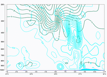
PV and Omega
|
04 August 2006/12.00 UTC - Vertical cross section; dark green: potential vorticity, cyan: vertical motion (omega)
|
|
|
|
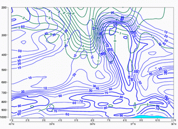
PV and Relative Humidity
|
04 August 2006/12.00 UTC - Vertical cross section; dark green: potential vorticity, blue: relative humidity
|
|
|
|


