Arctic Cold Front - Cloud Structure In Satellite Images
by FMI
Arctic Cold Fronts are usually so far north that Meteosat images alone are inadequate to recognize them. Also, the following conceptual models may look like Arctic Cold Fronts: polar Cold Front, Polar Low and Comma. The final check is best made using a loop of AVHRR images with the help of numerical model parameter fields.
- Baroclinic fronts
These fronts resemble polar cold fronts, but are usually not so extensive. The frontal cloudiness becomes more convective with time. - Ice/sea boundary fronts
These fronts forms over the ice/sea boundary and move southwards with the basic flow. There is only an isolated Cold Front. Often this type is so shallow and weak that it can not be detected in Meteosat water vapour images.
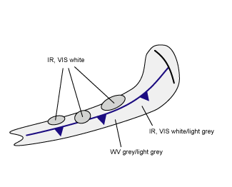
Appearance in Meteosat images
- light grey to white band in IR and VIS images
- light grey to grey band in WV images
|
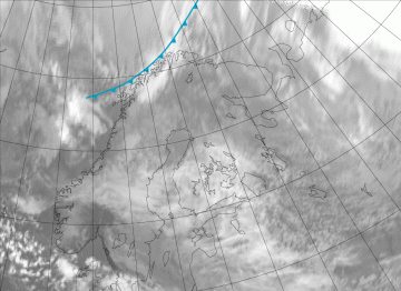
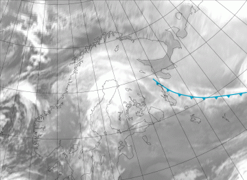
23 March 2009/12.00 UTC - Meteosat 9 IR 10.8 image. The location of the Arctic Front is shown in the images with a frontal line.
|
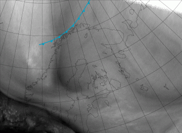
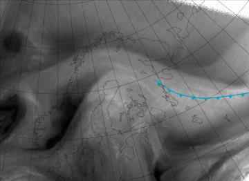
23 March 2009/12.00 UTC - Meteosat 9 WV 6.2 image
|
|
|
|
|
|
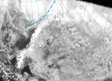
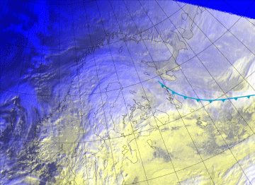
23 March 2009/12.00 UTC - Meteosat 9 VIS 0.6 image
|
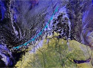
23 March 2009/11.29 UTC - NOAA 18 VIS 0.6 + VIS 0.9 + IR 10.9 RGB image
|
|
05 February 2009/09.00 UTC - Meteosat 9 IR 10.8 image. The location of the Arctic Front is shown in the images with a frontal line.
|
05 February 2009/09.00 UTC - Meteosat 9 WV 6.2 image
|
|
|

|
|
|
05 February 2009/09.00 UTC - - Meteosat 9 VIS 0.6 image
|
05 February 2009/09.00 UTC - Meteosat 9 HRV + HRV + IR 10.9 RGB image
|

